Transit & getting around
Moodie and Bayshore O-Train stations are close to Crystal Beach. Downtown is 14.0 km away in a straight line, or 18.9 km by road (18 minutes with free-flow traffic).
The O-Train does not run through the Crystal Beach area yet: Moodie, just east, is the western end of Line 1.
Updated · Facts on this page link to their sources
OpenStreetMap lists Moodie, Bayshore, Pinecrest, Queensview and Lincoln Fields as open Confederation Line stations in the area, plus Bayshore Transitway Station. Wikipedia says Bayshore and Moodie are within walking distance from certain parts of the community.
OC Transpo's Route 58 was the primary route for the community as of 2021, according to Wikipedia. Confirm current routes on octranspo.com. The ONS reports 79.8% of workers commuted by car and 6.7% by public transit in 2021, and 49.6% worked from home.
Drive times
From the area centre. Straight-line distance from the area centre; driving distance and free-flow time from the OSRM demo router on OpenStreetMap roads (no traffic).
Parliament Hill (downtown Ottawa)
18.9 km by roadrouter.project-osrm.org
18 minby car
Stations and routes
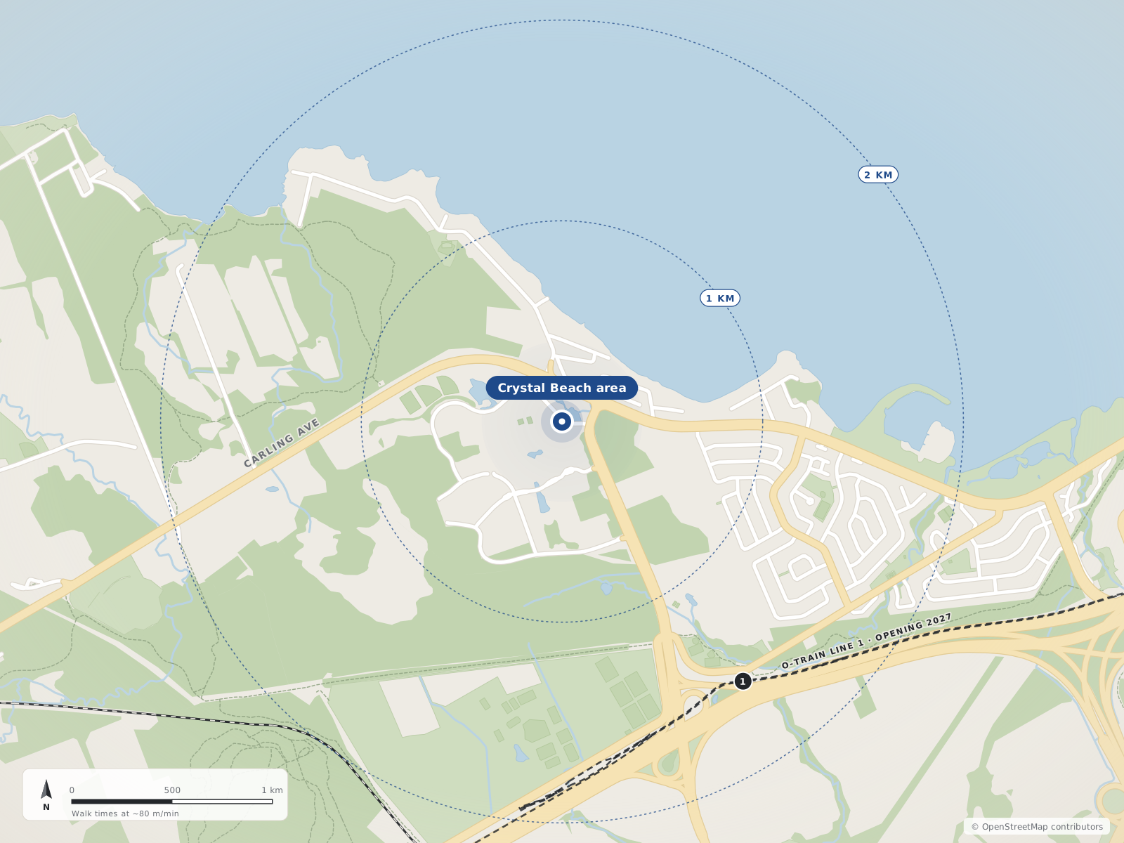
- 1Moodie1.6 km
O-Train stations
5Moodie
Confederation Line
OpenIn Crystal Beachopenstreetmap.org
Bayshore
Confederation Line
Lincoln Fields
Confederation Line
Pinecrest
Confederation Line
Queensview
Confederation Line
Transitway stations
2Bayshore Station
Bayshore Transitway Station
Open50 Woodridge Crescentopenstreetmap.org
Quick answers
Short answers first; each links to the full answer and its sources.
How far is Crystal Beach from downtown Ottawa?
From the centre of Crystal Beach to Parliament Hill is about 14.0 km in a straight line and 18.9 km by road. The free-flow driving time is about 18 minutes, with no traffic.
As of 2026-10 · router.project-osrm.org openstreetmap.org
What is the nearest O-Train station to Crystal Beach?
Moodie is the nearest O-Train (Confederation Line) station in the data, about 1.6 km in a straight line from the centre of Crystal Beach. Bayshore station is next, about 3.2 km away; both are listed as open.
As of 2026-10 · openstreetmap.org openstreetmap.org
How do people in Crystal Beach get to work?
In the 2021 census, 79.8% of workers in the ONS area 'Crystal Bay - Lakeview Park' commuted by car, truck or van and 6.7% by public transit. A further 49.6% worked at home.
As of 2021 · ons-sqo.ca
What bus serves Crystal Beach?
Wikipedia says OC Transpo provides public transit in Crystal Beach, with Route 58 as the primary route for the community as of 2021. The ONS reports an average of 6.9 transit stops within a 600 m walk.
As of 2021 · en.wikipedia.org ons-sqo.ca
Where is Bayshore station near Crystal Beach?
Bayshore has both an O-Train station (Confederation Line) and a Transitway station, both listed as open. The Bayshore Transitway Station is at 50 Woodridge Crescent, about 3.2 km in a straight line from the centre of Crystal Beach.
As of 2026-10 · openstreetmap.org openstreetmap.org
How easy is it to reach Highway 417 from Crystal Beach?
Wikipedia says Crystal Beach is served by two major arteries, Highway 417 and Carling Avenue. It describes the neighbourhood as about five minutes from Kanata and a 15-minute drive from downtown.
As of 2026-10 · en.wikipedia.org router.project-osrm.org